
In brief
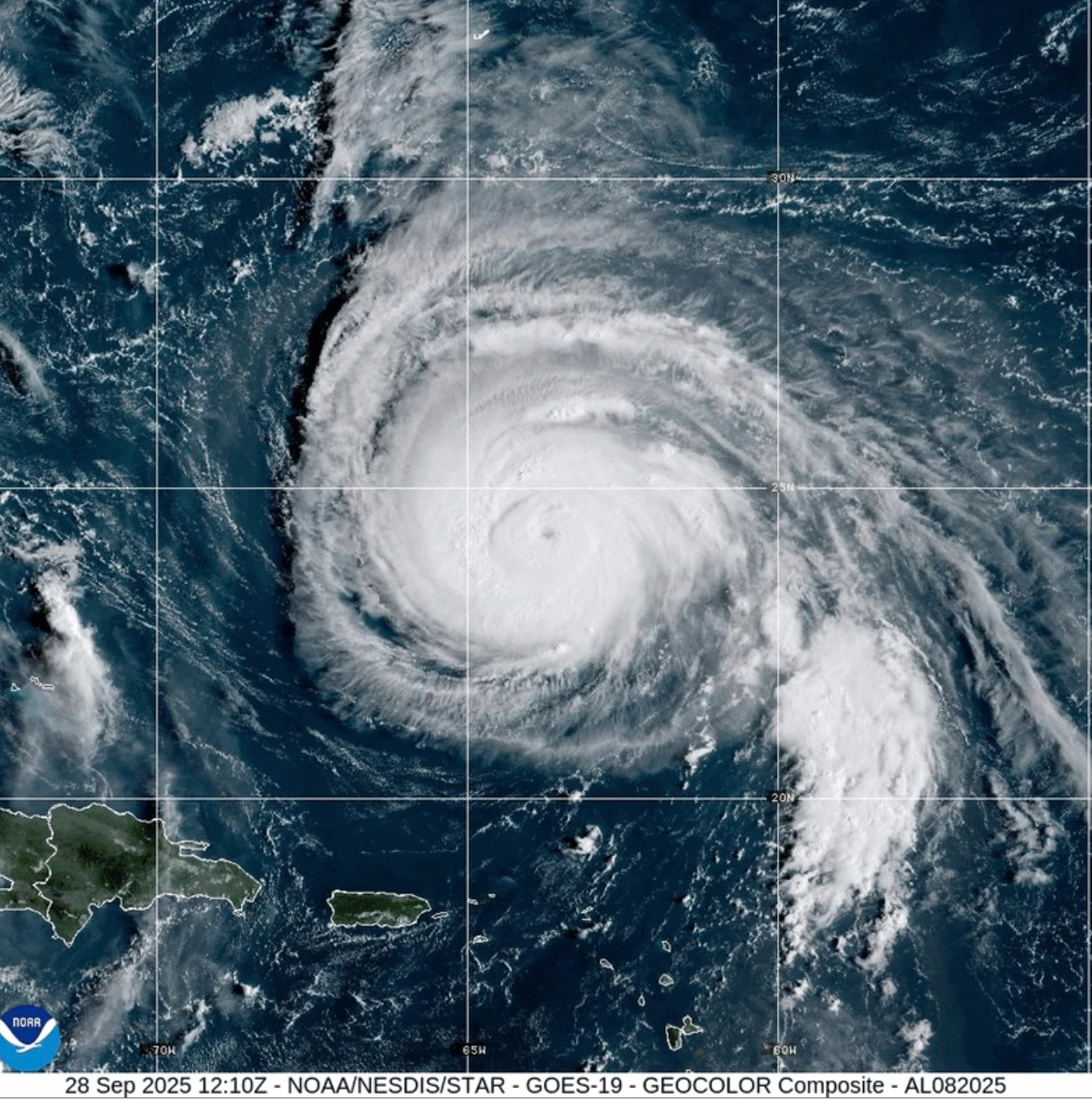
Hurricane Humberto, categorized as a powerful Category 4 storm, is moving northwest and expected to affect Bermuda and the U.S. East Coast with dangerous surf conditions. Simultaneously, Tropical Storm Imelda is intensifying, threatening parts of Cuba and the Bahamas with heavy rainfall and flooding, prompting warnings in affected areas.
MIAMI (AP) — Hurricane Humberto is expected to unleash dangerous surf for Bermuda and the U.S. East Coast this week, while Tropical Storm Imelda is gathering strength near the Bahamas, according to forecasters.
Early Monday, Humberto remained a formidable Category 4 storm, with a Tropical Storm Watch issued for Bermuda, as confirmed by the National Hurricane Center in Miami.
As of 2 a.m. EDT, Humberto was located approximately 400 miles (645 kilometers) south-southwest of Bermuda, moving northwest at 14 mph (22 kph) with maximum sustained winds reaching 140 mph (220 kph). The storm is forecasted to gradually turn before picking up speed towards the east-northeast by late Tuesday or early Wednesday. Although Humberto may fluctuate in intensity, it is anticipated to remain a major hurricane for the next few days.
Tropical Storm Imelda formed on Sunday, and the hurricane center reported that it is gradually gaining strength. At the same time, the storm is currently situated about 130 miles (210 kilometers) northwest of the central Bahamas and approximately 315 miles (505 km) southeast of Cape Canaveral in Florida.
Imelda is traveling northward at 8 mph (13 kph), with maximum sustained winds of 45 mph (75 kph).
Imelda Threatens Parts of Cuba and the Bahamas
On Sunday, the storm posed a threat to parts of Cuba and the Bahamas with predictions of heavy rainfall and flash flooding, leading to warnings across the region. The Bahamas’ Department of Meteorology stated that moderate to heavy rain would persist over the northwestern and central islands, including Nassau, Andros Island, San Salvador, and Long Island. The potential rainfall could sum up to between 6 inches (15 centimeters) and 12 inches (30 centimeters) in total, with isolated spots accumulating up to 10 inches (25 centimeters).
Residents in low-lying areas should take precautions to mitigate potential property damage due to flooding, the department advised.
As the usually bustling streets and seaside of New Providence Island fell silent, light yet consistent rain began flooding roads, influenced by high surf and gusty winds that deterred tourists and locals from visiting the busy Potter’s Cay Dock in Nassau.
As airports cancelled flights to and from the Bahamas, officials anticipated that conditions would improve necessitating reopening as weather stabilized.
South Carolina Governor Henry McMaster indicated that Imelda could result in high winds and severe flooding in his state, where preparations included deploying search and rescue teams over the weekend. We consistently learn that the exact path of storms remains uncertain, McMaster stated. “This storm is not just serious; it is deadly serious.”
North Carolina Governor Josh Stein preemptively declared a state of emergency before Imelda formed.
___
Frisaro reported from Miami. Contributions were made by Associated Press writers Safiyah Riddle in Montgomery, Alabama, and Regina Garcia Cano in Caracas, Venezuela.